Our Location today is Sevierville, Tennessee, USA.
We were eating breakfast shortly after 8:00 this morning
because we had figured we would use up Plan B & C that
we had made for yesterday. Armed with the cameras and the instructions on how
to get to our destination we were leaving the RV Park shortly after 9:00 this
morning. Thinking there was a possibility we would visit both our destinations
in the one day we did bring the GPS but kept it in the back seat. We couldn’t
enter the address of our first destination because we didn’t have one and it
wasn’t even listed in the points of interest in the GPS itself. Since the
directions were vague Turn at Traffic light #3 in Pigeon Forge and turn on Wears
Valley Road and take 321 to Townsend. Now
instructions like that might make perfect sense to someone who knows the local
geography but to us that just left a lot of questions. Like turn right or left? Confusing but we
figured it out.
Since we had to go down the Strip through Pigeon Forge and
the sun was actually shining this morning we took the half hour ride to drive
two miles until we saw a number #3 at a traffic
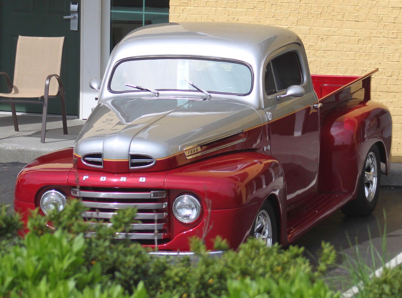
light. We used this short time to see a very small fraction (Hundreds) of the
Street Rods (Thousands) that were in attendance for this annual gathering. Of course
we were in the wrong lane to make the turn so we used a turning lane to swing
around.
We were confident that we were on the right road but all
directional signs we were seeing none said 321 or Townsend. Finding a parking
lot we again changed direction heading back to the intersection on the Strip we
had just taken. Traffic was so congested that a police officer was using a
plug-in controller to operate the traffic signal. Once we were again moving through
the intersection about two hundred feet up the road was a sign pointing us in
the direction of Townsend.
It was only a twenty mile trip from Pigeon Forge to Townsend
on 321 but it was a twenty mile roller coaster ride that was worse than the
ride we taken the other day on 441. It was past 11:30 by the time we reached
Townsend and we thought it wise to have lunch before continuing.
We ate at the Campfire Grill on
the corner of 321 and old Highway 73. This is a Mom and Pops diner set up like
most fast food places today. You walk in, read the menu off the wall, place
your order, pay for it, give your name and sit down. When your order is ready a
waitress calling your name delivers it to your table. Everything was cooked
fresh, was very reasonably priced and was ready in about five minutes. The
restaurant was clean inside and if you wanted to eat outside there was a patio
with picnic tables to use.
Back on old Highway 73 we continued until we turned onto
Laurel Creek Road. This road is a single lane twelve mile loop that runs
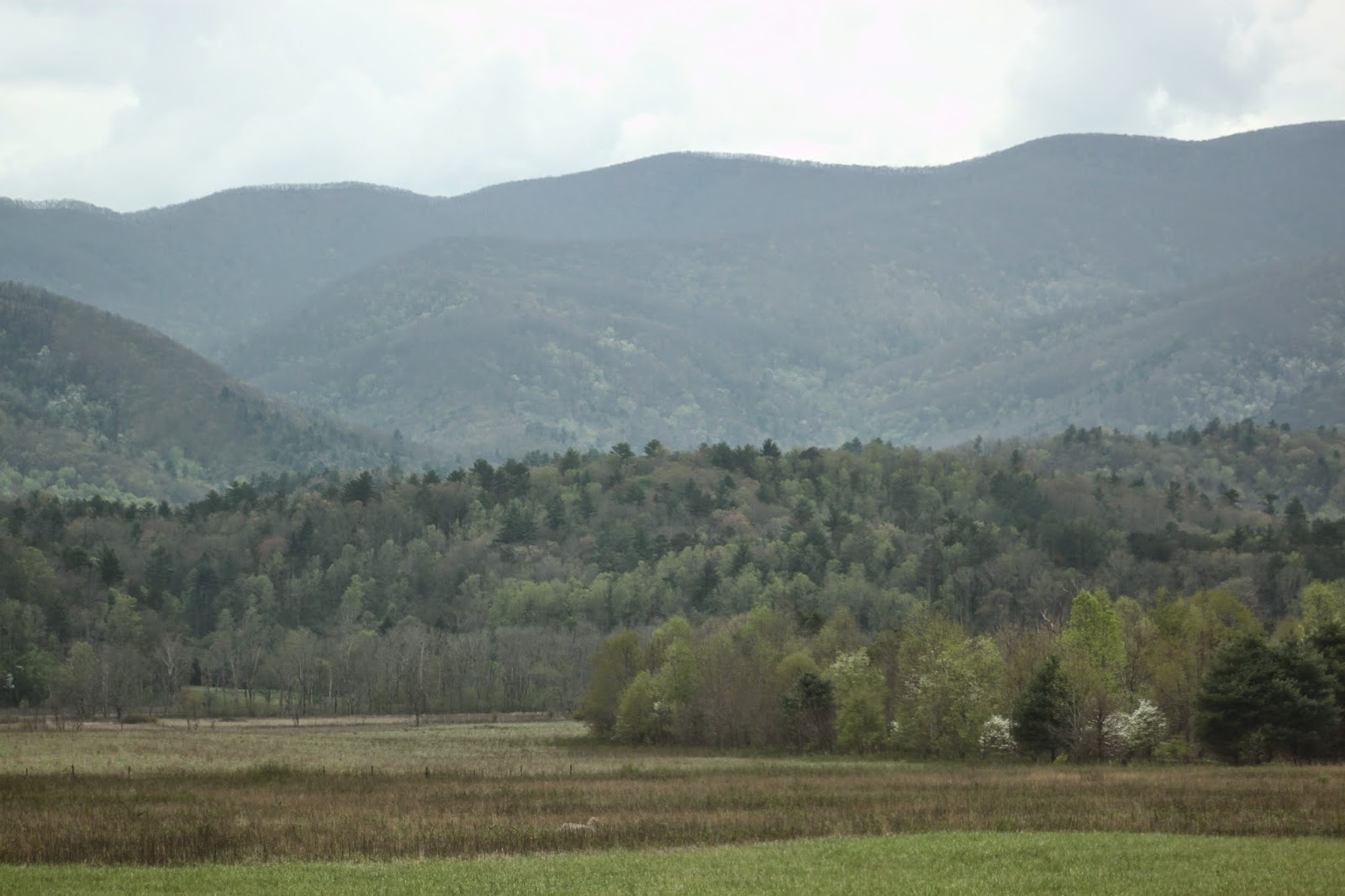
straight through Cades Cove which is a
National State Park in the Smoky Mountains of Tennessee and is shared by motor
vehicles as well as bicycles. There are a number of old homesteads and churches
as well as mills all located exactly where they were built long before the Civil
War. There are a lot of natural woodlands and valleys that are filled with
animals.
We had no sooner entered the park when the bumper-to-bumper
traffic came to a stop. Someone had spotted a mother bear and her cubs and had stopped
on a pull over to take pictures. Then other cars stopped on the road and soon
nobody was going anywhere. It didn’t take long for the park rangers to fix that
mess.
There was always some parking even though not always a lot at
the different sites along the way so that you could personally see these
historic structures. Some being fairly close to the road while others required
hiking on trails through the forest or through meadows. We visited a number of
the sites and had to hike in for a few. Due to the high elevation Kathy struggled
with her breathing.
The last site we visited was at the far end of the Laurel
Creek Road loop they had the Grist Mill that was located near the Visitors
Center. That’s right the Cades Cove Visitors Center was located near the back of the park not the
front entrance. We were just about finished looking around the mill when the
rain we were not supposed to get today started.
The rain made the bumper-to-bumper drive a lot trickier
especially when you had to drive up a steep grade and all you could see was sky
then in a second or two you’d be hitting your brakes as you were looking at the
bumper of the vehicle ahead of you on an equally steep grade going down.
It was after 5:00 by the time we exited the park and reversed
our drive back to Pigeon Forge. Due to the rain having gained in intensity we
thought that the Rod Run would have
closed up. No! As we got closer to Pigeon Forge there was no rain. When we got
stopped in the mobile parking lot a half mile from our turn I noticed others
driving down back roads. I took the chance and followed them and got lucky.
It was nearly 6:30 when we pulled into Chick-fil-A to have our supper. While sitting there the rain
got so bad we had a hard time seeing the truck parked only a hundred feet from
the building. When we left the bumper-to-bumper traffic in all lanes heading
into Pigeon Forge in the pouring rain was well past the entrance to the River
Plantation RV Park where we are staying. Glad we were going the other way. It
was a very enjoyable day with some hiking and lots of driving. I would
recommend this self-guided tour to anyone visiting Pigeon Forge area. It is
busy and slow so plan a day of it and be patient and bring water to drink and
some snacks.
Sine we only accomplished Plan B
today we’ll try to do Plan C tomorrow.
Thanks for following along and feel free to leave a comment. Be Safe and Enjoy!
It’s about time.
Most of today's pictures
were taken by Kathy.
Most of today's pictures
were taken by Kathy.
Krackers
You
Might Be a Redneck If
The
tallest building you've ever seen was a water tower.


We were there the same time two years ago! Experienced (I won't say enjoyed) the same Pigeon Forge parking lot, and the same Cade's Cove drive.
ReplyDeleteWe love that area of Tennessee. You all saw a lot in the area! Nice pictures of Cades Cove.
ReplyDeleteAs soon as you mentioned the road you were looking for, I knew where you were headed. We've done the Cades Cove driver a few times, and I think I have pictures of the boys standing in those exact same spots along the creek! We never did see a bear there, though . . .
ReplyDelete